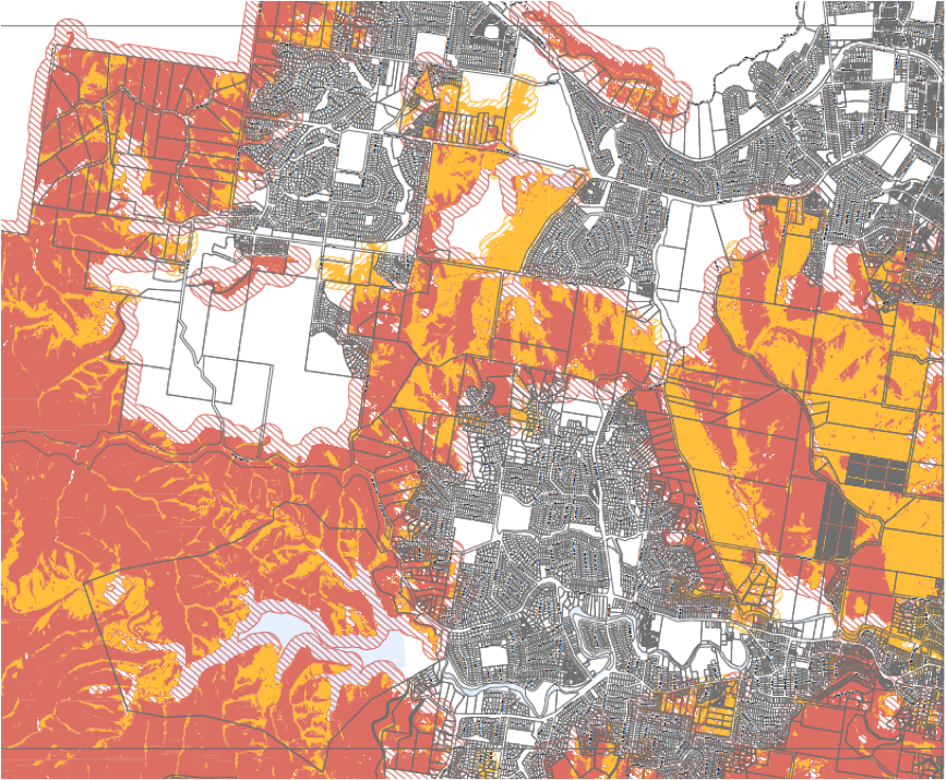
The Brisbane City Plan 2014 introduced a number of ‘overlays’ within the new planning scheme. These twenty-six overlays identify when applicable codes relate to a site, and cover a wide range of considerations from flooding to building heritage and character. The bushfire overlay addresses bushfire hazard. Many people living adjacent to natural parklands within Brisbane may be surprised to know that their property is identified in the bushfire overlay. Whilst part of Building Code requirements for some time, these Building Code requirements have only been triggered in Brisbane with the establishment of the bushfire overlay in 2014.
For development projects in Queensland, bushfire hazard assessments now form an essential component of development applications where the relevant Council’s overlay mapping identifies potential risk. In some instances, these assessments are what should now be expected as standard however, the issue which is far less recognised is that these overlay maps can result in construction requirements under the Building Code of Australia (BCA) to allow buildings to better withstand the impacts of bushfire attack, resulting in increased project construction costs for residential projects.
Depending upon the type of vegetation that may be in proximity, the topography of the area and separation distance between vegetation and the building façade, construction requirements for development within 100m of the bushland interface can be triggered, with more rigorous requirements identified within 30m. Council bushfire hazard overlay maps form the trigger under the BCA for assessment of development against Australian Standard AS3959-2009 – Construction of Buildings in Bushfire Prone Areas. AS3959-2009 incorporates six bushfire attack levels (BALs) ranked from BAL-Low (negligible hazard) to BAL-Flame Zone and the thresholds for each is typically based on the factors identified above.
Depending on the BAL classification, the building construction requirements that are triggered can add several thousand dollars, perhaps even tens of thousands, to the average build cost depending upon the type of design and materials identified. Additionally, many Councils have also recently started regulating against higher BAL construction by introducing specific planning provisions which mandate building siting in proximity to hazardous vegetation in an effort to lower the extent of risk exposure. These requirements can result in major impacts not only on project viability, but project design and layout also. In many instances, project yield can be affected.
It is critical to seek bushfire advice in the early stages of a project and undertake a robust hazard assessment that contemplates an options analysis, to provide advice on the range of opportunities available to maintain development yield and satisfy project needs. Limiting or minimising potential construction costs and avoiding difficulties in design and layout underscore the importance of appropriately qualified assessments, adding significant value to the overall success and viability of development projects within bushfire prone areas.
Vesi work closely with experienced planning consultants and in situations where bushfire planning is relevant, with a bushfire planning specialist. If you have a development site where this may be a potential issue, Vesi and our consultants can assist.
By Jason Hedges (Vesi Developments) and Laura Gannon (Senior Planner & Bushfire Planning Specialist – Jensen Bowers Group)
If you would like to be kept informed of topical issues in the property development sector, please subscribe to our newsletter.